Almost 900 rivers flow in the Ryazan region. Even the Oka, the longest river in the region, has a length of less than 500 km in the region. The rivers of the region are characterized by a flat character, a tortuous channel, a small slope and a calm current. The shores are of a forest-steppe and subtaiga nature. There are wetlands, mainly in the headwaters of rivers. Many large rivers of the region also flow in other regions.
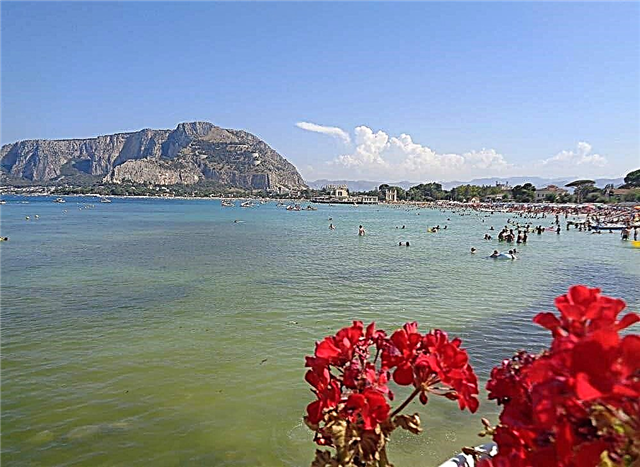
In tourism, the rivers of the Ryazan region are used for rafting and recreation by the water. The slow flow of rivers allows fans of kayaking to appreciate the beauty of the nature of the banks. Many rivers have beach areas, and in summer the water warms up to a comfortable temperature for swimming. Several rivers flow through the territory of national reserves or near natural monuments.
The longest rivers of the Ryazan region
List of the largest rivers flowing through the region.
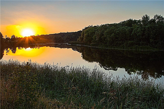
Oka
A picturesque river, which is one of the largest tributaries of the famous Volga. One of the famous sights on the banks of the river is the Ryazan Kremlin. It is built on a high hill with panoramic views of the winding riverbed. The Oka flows through the Oryol, Ryazan, Kaluga, Tula, Vladimir, Moscow and Nizhny Novgorod regions.
The length of the river is 1500 km, in the Ryazan region - 489 km.

Moksha
Tributary of the Oka River. Presumably, the name of the river comes from the name of the goddess of fertility of the pagans - Mokosh. The riverbed winds through green meadows, the low banks are covered with bushes. There are sandy shores where you can swim. Along the entire length, Moksha is attractive for fishing. It flows through the territories of the Republic of Mordovia and three regions - Ryazan, Penza, Nizhny Novgorod.
The length of the river is 656 km., In the Ryazan region - 134 km.

Tsna
A flat river with a calm flow, used for rafting. An obstacle is several dams that need to be bypassed along the shore. Leisure on the banks of the Tsna is varied. This includes hiking in the forest for berries and mushrooms, and walking on bicycles or off-road vehicles, and resting in tents among picturesque places, and fishing or hunting. It flows through the Ryazan and Tambov regions.
The length of the river is 656 km., In the Ryazan region - 127 km.

Pronya
A shallow and winding river that flows through a narrow valley. The bottom of the river is muddy, with small rocky and sandy areas. Fishing in the river is considered especially good in the lower reaches. In addition to fishermen, tourists often come to the river. On the banks of the Pronya you can enjoy the majestic views of the real Russian nature. It flows through the Ryazan and Tula regions.
The length of the river is 336 km, in the Ryazan region - 320 km.

In hell
A meandering river flowing along forest banks with small meadows. There are many oxbow lakes in the floodplain of the river, especially in the lower reaches. The Wad River is popular with both water tourists and fishermen. It is inhabited by pike, bream, swine-bream, chub and catfish. The river has several tributaries, the longest being over 100 km. The Wad flows through the Ryazan and Penza regions, as well as the Republic of Mordovia.
The length of the river is 222 km, in the Ryazan region - 15 km.

Couple
Tributary of the Oka River. The river is suitable for rafting during floods - in late spring and early summer. The Couple has practically no steep banks. The pair is fed mainly by snow, partly by rain. There are several of its tributaries ranging in length from 14 km to 75 km. Most of the tributaries are suitable for kayaking. The pair flows through the Tambov and Ryazan regions.
The length of the river is 192 km, in the Ryazan region - 174 km.

Higher
In the upper reaches, the river is known as Knoxa. The upstream flows through forest, partly wetlands with meadows. The river bed is meandering, the banks on the right side are steep, on the left - gentle. The cliffs of the banks reach 7 meters. The river flow on the rifts reaches 0.7 m / s. It flows through the Ryazan and Penza regions, as well as through the territory of the Komi Republic.
The length of the river is 179 km, in the Ryazan region - 32 km.

Pra
The source of the river is in the Svyatoe Lake. The river flows through Meshchersky forests, Klepikovsky lakes and Oksky reserve. These are scenic spots that any traveler will love. A mixed forest of aspen, birch and alder grows on the banks of the Pra; in late spring, many lilies of the valley bloom in it. The beach areas of the shores are wide with a smooth entry into the water. Pra flows through the Ryazan and Moscow regions.
The length of the river is 167 km, in the Ryazan region - 155 km.

Ranova
Tributary of the Pronya River. The banks of the river in the upper reaches are high and steep, then they become gentle and partly swampy. There are wide sandy areas with pine forests. It is recommended to travel along the river from May to July. There are few obstacles in the form of small shoals. The lower and middle reaches of the river are more suitable for fishing. It flows through the Lipetsk and Ryazan regions.
The length of the river is 166 km, in the Ryazan region - 142 km.

Goose
This is one of the most picturesque tributaries of the Oka. The clear waters of the river are suitable for water travel. Most of the area of the river basin is wooded, a small part - meadows. The gently sloping banks are covered with shrubs, reeds and undersized trees. The river is 1.5 meters deep and 10 meters wide. The goose flows through the Vladimir and Ryazan regions.
The length of the river is 147 km, in the Ryazan region - 59 km.

Unzha (tributary of the Oka)
A beautiful river that is attractive to fishermen and tourists. Pike, dace, roach, perch, bream are well caught in Unzha. Kayaking is especially popular in the lower reaches. There are rapids and rifts here, but the river bed is partially littered with flooded logs. On the banks of the Unzha there are ancient villages, birch and pine forests. It flows through the territories of two regions - Vladimir and Ryazan.
The length of the river is 122 km., In the Ryazan region - 47 km.

Piet
Formed by the confluence of the Patsha and Pisarevo rivers, it flows into the Oka. Pet is a river with steep banks, which reaches a width of 40 meters. There are also beach areas on it. The shores are overgrown with bird cherry and willows. Beaver dams are common. The meandering tributaries are clogged with snags. In spring, you can see different species of waders here. People come from all over the region to hunt geese on the banks of the Pet River.
The length of the river is 110 km.

Tyrnitsa
It begins in the springs near the village of Fedosovo, flows into the Oka. At the mouth of the river there are interesting creeks of Pereolok and Kurva. The banks of the Tyrnitsa are open in the upper reaches, while pine forests appear in the middle reaches. There are good exits to the river. They are especially interesting for fishermen, there is a good catch of catfish, ide, roach, perch and bream. The river has tributaries. The longest of them reaches a length of 30 km.
The length of the river is 105 km.

Leader
The source of the river is located in artificial reservoirs near the village of Komsomolsky. Vozha is a tributary of the Oka River. Every year a large festival is held near the village of Glebovo-Gorodishche, gathering thousands of people. It is dedicated to the battle between the troops of Dmitry Donskoy and the Tatar-Mongol troops in 1378, two years before the Battle of Kulikovo. At this point, the Vozha flows among hilly banks with deep ravines.
The length of the river is 103 km.

Hupta
Tributary of the Ranova River. The source of the river is located in the Ukholevsky region near the village of Volynshchino. The Hupta flows out of a small lake. In the upper reaches, it flows through the steppe plain, through meadow treeless terrain. The water in the river is clear, the current is slow. There are many villages along the banks of the river. A small dam has been built, which canoeists have to bypass. The river is inhabited by carp, pike, roach.
The length of the river is 101 km.

Istya (tributary of the Oka)
The river is not navigable. Its source is located in the springs of the Zakharovsky region. It is a flat river with high spring floods. Fishing on it is popular in summer, because in winter the fish leaves Istya for Oka. The largest tributary is the Kazachya River, 27 km long.On the river is the village of Starozhilovo, where you can see the graceful Church of Peter and Paul, built in 1892.
The length of the river is 94 km.

Kolp (tributary of the Goose)
The source of the river is located near the village of Borzino. The Gus flows into the river near the village of Gus-Zhelezny. The Kolpi upper reaches flows among meadows, then among forests. Currently, the river is shallowing upstream. The water in the river is very clean, even crayfish live in it. The tributaries of the Kolp River are the Charmus and Lavsinka rivers. The river freezes in April and opens up in April. Kolp flows through the Vladimir and Ryazan regions.
The total length of the river is 93 km.

Yermish
The river originates in the forests of Vyksa. It flows into Moksha. A dam was built on it near the village of Yermish, which forms a reservoir. The people call it the Ermishinsky pond. It is a natural monument. Water tourism is developed in this place. Fishing is also popular on the Ermish River - rotan, crucian carp, perch, roach, pike are found in it. It flows through the territories of the Nizhny Novgorod and Ryazan regions.
The total length of the river is 85 km.

Mostya
The source of the river is in the ravines near the village of Uholovo. It flows into the Ranova River and is part of the Volga river basin. Mostia has five large tributaries ranging in length from 14 km to 23 km. The area of the entire river basin of the river is 984 km². Before the confluence with the Uda, the locals are called Malaya Mostya. The banks of the river are steep, partly swampy. Mostye is inhabited by crucians, perches and pikes.
The length of the river is 77 km.

Verda (tributary of the Pair)
It flows through the Tambov and Ryazan regions. The source of the river is located on the border of the regions near the village of Bolshaya Verda. It flows into Paru near the villages of Borets and Sysoi. In a small area near the Verda station, the river is suitable for kayaking. Most of the river flows through the steppe plain. Verda has three tributaries - Verditsa, Boka, Vitusha. The village of Sarai, founded in 1640, is located on the river.
The total length of the river is 75 km.

Wet Tabola
The riverbed is beautiful with a lot of lilies and water lilies in it. The average depth of the river is 1.6 meters, the maximum depth reaches 3.7 meters. Mokra Tabol is inhabited by perch, crucian carp, podust, pike, roach. One of the tributaries of the Mokraya Tabola River is the Sukhaya Tabola River with a length of 39 km. The catchment area of the basin is 795 km². It flows through the Tula and Ryazan regions.
The total length of the river is 64 km.

Narma
It flows in the north of the region and is a tributary of the Gus River. There are peat bogs at the source of the river, so the water in the river looks brown. The depth of the river varies - there are also shallow half-meter sections, and whirlpools up to 10 meters deep. Most of the shores are covered with forests and meadows, there are several wetlands. Throughout the entire length of the Narma, several tributaries of different lengths flow into it.
The length of the river is 63 km.

Braid (tributary Trubezh)
The source of a small river is located near the village with the interesting name Good Bees. This is an old village that was formed in 1574. At its confluence with the Pavlovka River, Pletenka forms the Trubezh River. The Vyderka brook is a tributary of the Plethenka. The Pletenka drainage basin is 395 km². Braid is included in the Volga river basin. The area around the river is swampy, there are peat bogs.
The length of the river is 60 km.

Pozhva (inflow of the Pair)
It flows through the territories of three districts of the region. It flows into the Paru near the village of Krasny Utyug. The source is located near the village of Zhelobovo. Pozhva's tributaries are the Moshka and Korovka rivers, and the Cheremoshnya stream. There are vast meadows along the banks of the river. Pozhva is a shallow river with gentle banks. In some places, the depth is only 0.5 meters. The river is inhabited by common fish species - perch, pike, crucian carp.
The length of the river is 59 km.

Kerd
It flows out of the small lake Surovtsy, Skopinsky district. It flows into the Pronya River near the village of Pronsk. Archaeologists have confirmed that the first settlements of people in these places were in the Iron Age, and Pronsk itself was first mentioned in the Nikon Chronicles in 1131. Currently, the river is heavily polluted by waste from industrial enterprises built on the river. Swimming and fishing in Kerdi is prohibited.
The length of the river is 57 km.