The Yaroslavl region is beautiful for its history, culture and, of course, nature. There are more than 4300 rivers in the region, of which 11 are rivers with a length of 100 to 150 km. Most of them are tributaries of the Volga, or tributaries of its tributaries. Some of them carry their waters to the largest lakes in the region - Nero and Pleshcheyevo. The largest rivers in the region after the Volga are: Kostroma, Nerl, Sit and Ustye.
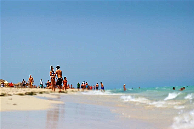
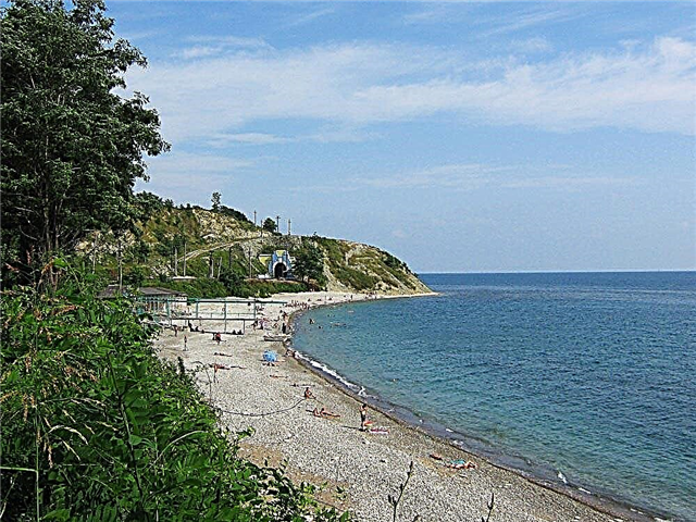
All waterways of the Yaroslavl region are united by a flat character and a calm current. They cover the region with a dense network. Fishing is popular everywhere: both on the Volga and on numerous rivers and lakes. They also have rich recreational potential: there are sanatoriums with mineral springs, recreation centers and summer camps for children. There are dozens of routes for a fascinating rafting among picturesque forests, past historical sites.
The longest rivers of the Yaroslavl region
List of the largest rivers flowing through the region.
Volga
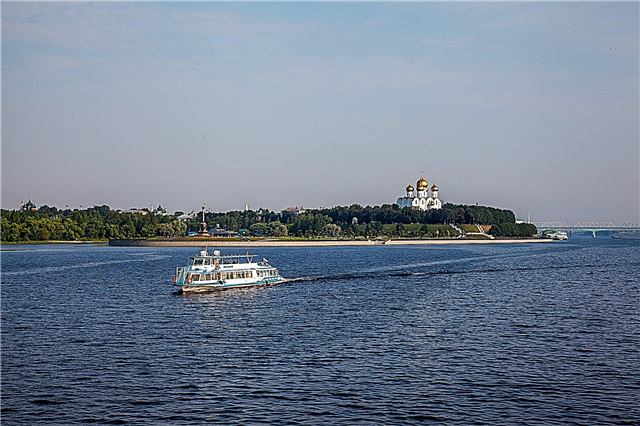
The most important river in Russia is considered the cradle of the Yaroslavl region. The history of the region's capital is inextricably linked with the great river. Thanks to her, the ancient city received its development as the center of trade and culture of our country. And today, the main part of the city is oriented towards the Volga, it stretches along the river for 30 km. Within the city limits Kotorosl flows into the Volga. Part of the upper course passes through the region.
The length of the river is 3530 km, in the Yaroslavl region - 340 km.

Kostroma
The main part of this river is located in the neighboring Kostroma region, and the mouth is in the capital of the region, which they gave the name to. It flows into the Gorky reservoir. Part of the upper course of the Kostroma runs along the border of the Lyubimsky district of the Yaroslavl region, the channel is winding, lies in the high wooded banks. The reserve "Kologrivsky forest" is founded here, where the fish fauna of the river, coastal vegetation and fauna are studied.
The length of the river is 354 km, in the Yaroslavl region - 50 km.

Nerl (tributary of the Klyazma)
Passes through the Yaroslavl, Kostroma and Ivanovo regions. On the Yaroslavl land is the source of this river, near the village of Lychentsy, Pereslavl region. The upper course of the Nerl is a forest river in high hilly banks. These places are well suited for river rafting: beautiful landscapes, convenient parking, small population. In the lower reaches, before the confluence of the Klyazma, on the Nerl there are famous sights: the Church of the Intercession and the residence of Andrei Bogolyubsky.
The total length of the river is 284 km.

Sit
The river flows from the Tver region to the Yaroslavl region. It was once a tributary of the Mologa, now the mouth is located along the southwestern shore of the Rybinsk reservoir. There are memorable places along the entire river bed; here in the 13th century the Sita battle took place between the troops of the Mongols and the prince of Vladimir Yuri Vsevolodovich. The strand has a flat character, in the middle reaches it spills up to 40 meters wide, often bends.
The length of the river is 159 km, in the Yaroslavl region - 100 km.

Estuary
The river originates in the Uglich region, near the village of Zaozerye. A small stream flows out of the forest swamps, but it is gaining strength very quickly. In the upper reaches there are banks overgrown with coniferous forest, to the lower reaches the area is mostly open. The river often winds, forks, forming islands, the current is fast. From the source to the mouth, there is a significant difference in elevation. In the Rostov region, near the village of Nikolo-Perevoz, it merges with Vyoksa, giving rise to Kotorosl.
The length of the river is 153 km.

Korozhechna
It originates on a hill in the Tver region, in the lower reaches it falls on the territory of Yaroslavl. It flows into the Volga along the left bank of the Rybinsk reservoir, downstream of the city of Uglich. Approaching the reservoir, Korozhechna expands significantly, the last 4 km of its route are navigable. There are good rest and fishing here, there are many tourist centers, the shores are densely populated.
Length - 140 km, in the Yaroslavl region - 45 km.

Honeycomb
It passes through three districts of the Yaroslavl region: the upper reaches are in Pervomaisky, and along the lower reaches the border of the Danilovsky and Lyubimovsky districts passes. It originates from the border with the Vologda region, in the upper reaches it lies in the high forest banks. The current is fast, sometimes there are rapids. After the village of Titovo, in the backwater of the reservoir it spreads widely, forming bends. It flows into the Kostroma Bay at the Gorky Reservoir.
The length of the river is 144 km.

Solonitsa
The right tributary of the Volga passes through the Kostroma, Ivanovo and Yaroslavl regions. It flows on an open plain, in the Yaroslavl region Solonitsa overflows significantly, and the current slows down. The last 10 km of the channel are used for navigation. It got its name for the many mineral springs located in the river valley. Popular among fishermen, as well as for recreation and health improvement. There are many sanatoriums in the lower reaches.
The length of the river is 132 km., In the Yaroslavl region - 30 km.

Uhra
The former tributary of the Sheksna, after the formation of the Rybinsk reservoir, flows into it in the southeast. It originates in the forest bogs of the Tutaevsky district, in the upper reaches it is lost among the bogs and is again formed below the village of Zinovskoye. Taking many tributaries, it is rapidly gaining strength. The channel width is up to 30 meters, the depth is from 4 to 0.2 meters. In the lower reaches, due to the backwater of the reservoir, it spills up to 200 meters, there is a lot of fishing here. 10 km to the mouth are navigable.
The length of the river is 135 km.

Obnora
The right tributary of the Kostroma flows from the Vologda Oblast to the Yaroslavl Oblast. The river is known not only for its good fishing spots. On its banks are ancient monasteries, as well as the city of Lyubim, known since 1538. In the upper reaches of the Obnor it is not wide, very winding, expanding to 30 meters towards the middle course. It flows through the forests, the river flow is fast enough.
The length of the river is 132 km, in the Yaroslavl region - 90 km.

Sogozha
The former tributary of the Sheksna, flows through the Vologda and Yaroslavl regions. It flows into the Rybinsk reservoir in the east. In the second half of its journey, the river gains strength significantly, the channel reaches 30 meters in width, closer to the reservoir it overflows up to 200 meters and slows down the current. 30 km to the mouth are navigable. Not far from the mouth is the ancient town of Poshekhonye, its surroundings are densely populated.
The length of the river is 129 km, in the Yaroslavl region - 90 km.

Kotorosl
The right tributary of the Volga, formed from the confluence of two small rivers: the Ustya and the Vyoksa. Sometimes Vyoksa is considered the beginning of Kotorosl. The estuary is located within the city of Yaroslavl, in this place a picturesque arrow is formed. Also on the river are the city of Gavrilov-Yam and the village of Krasnye Tkachi. The width of the channel is 30-60 meters, it often bends, in the lower reaches it forms large bends, the current is calm. From the middle to the mouth there are many rest houses, summer cottages, settlements.
The length of the river is 126 km.

Nerl (tributary of the Volga)
It flows through the territory of the Tver and Yaroslavl regions. It originates from the Yaroslavl Lake Somino, flows into the Volga along the right bank near the village of Sknyatino in the Tver region. The depth of the river does not exceed 2 meters, in some places the channel is overgrown with reeds and bushes. Width from 30 to 75 meters in the main course, about 200 meters near the mouth.
The total length of the river is 112 km.

Ukhtoma
A narrow fast river winding through the woods. It originates in the Vologda region from the confluence of two rivers. The middle and lower reaches of the Ukhtoma pass through the Yaroslavl region. The estuary is located in the Poshekhonsky region, where Ukhtoma flows into Sogozh below the village of Yudino on the right bank. At the confluence of the tributary, the Kashin flows among a dense coniferous forest. Large stones come across in the channel.
The length of the river is 92 km, in the Yaroslavl region - 88 km.

Kubr
It originates in the Yaroslavl region, 20 km from the city of Pereslavl-Zalessky. It flows out of the Lyakhovsky swamp. It flows into the Nerl Volzhskaya on the territory of the Vladimir region. The channel is not wide, in steep banks, boulders come across in places.Several dams have survived on the river, and a hydroelectric power station and a small reservoir in the lower reaches. A nature reserve has been formed at the mouth.
The total length of the river is 91 km.

Saggy
It originates in the Ivanovo region, then part of the channel runs along the border of the regions. The estuary is located in the Yaroslavl Region, below the village of Strokovo, on the right bank of the Kotorosl River. The river is not wide, very meandering, there are rifts and remnants of mills, old bridges. In the lower reaches it flows along a treeless plain, winds strongly. A nature reserve has been formed near the mouth, beavers and otters are found here, fish spawn.
The total length of the river is 91 km.

Sarah
A small river in the south of the Yaroslavl region. It flows out of the swamps on the Borisoglebsk Upland. It carries its waters to Lake Nero, in front of the mouth it forms a vast swamp. It receives about five main tributaries along its entire length. Lies on low, treeless shores, among a wide plain. There are dams. In the lower reaches there is the village of Petrovskoe, where the river passes under the railway bridge.
The length of the river is 93 km.

Teaching
The source of this river is in the Vologda region, but the main part of the channel is in the Pervomaisky and Lyubimsky districts of the Vologda region. It flows mainly to the east, but makes turns many times. The channel is narrow, winding, in places with islets of bushes, a forest approaches the banks. Within the city limits, Lyubim flows into Obnora along the right bank. The city is famous for its ancient history and sights.
The length of the river is 87 km, in the Yaroslavl region - 81 km.

Mogza
It originates in the Bolsheselsky district of the Yaroslavl region, flows out of the swamps. The upper reaches of the river pass through deserted places, among dense forests. Here the river is narrow, deep, fast, on steep banks. In the middle reaches and lower reaches, the channel widens, passes through more open areas, there are settlements. In some places the shores are swampy. It flows into the Ustye River below the village of Makarovo in the Rostov region.
The length of the river is 84 km.

Uleima
The source of this river is in the Borisoglebsk region, here it flows out of the marshes and flows for the first kilometers through the marshy area. Here the channel is narrow, and the current is fast, overcoming the rifts. The banks are densely populated, the largest settlements are Uleima and Chiryakovo (a suburb of Uglich). In the middle course it expands, flows more calmly. In the lower reaches there is a reserve. Often forks, forming bends. In high water it is suitable for rafting.
The length of the river is 83 km.

Day
It originates in the north-west of the Yaroslavl region, flows out of the swamps near Kozmodemyanka. The upper current is directed to the southeast, then turns to the north and carries its waters to the Rybinsk reservoir. The width of the river is from 10 to 25 meters, the depth is up to 4 meters, in some places there are shoals. The last 10 km of the track in front of the reservoir are used for navigation. The lower reaches are convenient for tourist recreation and fishing.
The length of the river is 81 km.

Caste
A small river, completely located within the Danilovsky district of the Yaroslavl region. It flows out of the swamp, in the upper reaches it does not exceed 3 meters in width. In the middle course, the channel expands to 12 meters. It flows into the Kostroma Bay of the Gorky Reservoir. In front of the mouth it expands to 45 meters. It flows in the banks overgrown with deciduous forest, open areas are swampy.
The length of the river is 79 km.

Yukhot
It originates from swamps in the Bolsheselsky district of the Yaroslavl region. The river valley is completely inside the large bend of the Volga. It changes its character from a narrow winding river in the upper reaches to a calm wide river in the lower reaches. Starting from the middle of the path, the channel expands to 30 meters, and reaches 200 meters to the mouth. It flows into the Rybinsk reservoir, from the confluence of the Uleima tributary to the mouth of the river, the river is navigable.
The length of the river is 75 km.

Bird cherry
A small river that flows out of the vast Varegova Swamp in the central part of the Yaroslavl region. It flows through beautiful places, along the banks there are many settlements and children's recreation camps. The width of the river is from 10 to 40 meters. It flows into the Rybinsk Reservoir within the city of Rybinsk, forming an arrow. The districts of the city beyond the river bear the general name “beyond the Cheryomukha”. At the mouth of the river it is used for anchorage of ships.
The length of the river is 73 km.

It
The left tributary of the Volga passes through three districts of the Yaroslavl region. It flows down the slopes of the Danilov Upland. The main part of the channel is located in the Tutaevsky and Yaroslavsky regions. Before the mouth passes through Yaroslavl. It often bends along the entire path, forming bends. Suitable for rafting in spring. There are many summer cottages and children's camps along the banks.
The length of the river is 68 km.