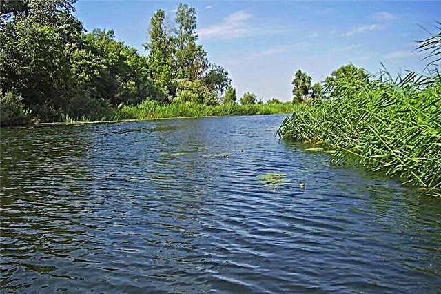
The Orenburg region unites the territories of the European and Asian parts of the Russian Federation. Almost all watercourses in this area belong to the vast basin of the Caspian Sea. So the rivers of the Orenburg region feed not only the Caspian Sea, but also the Volga with the Urals, as well as partly the Ob and drainless lakes in the southeast. The total length of the region's rivers is more than 31 thousand km. The river network of the region is represented by small rivers and streams.
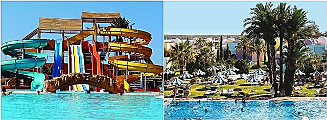
There are very few rivers in the south of the region, the rest of the directions are filled with canals, streams and large waterways. In the Orenburg region, rivers have a mixed type of feeding, in which snow recharge prevails in the off-season. Local water channels freeze in November and open in April. Floods occur in spring and summer. Tourism on the Orenburg rivers is well developed. Water excursions, kayaking and rafting are actively practiced by tourists.
The longest rivers in the Orenburg region
List, photo with names and descriptions of the largest rivers in the region.
Ural
A border river that unites the lands of Kazakhstan and Russia. The water area is 231 thousand km². The waters of the river flow into the Caspian Sea. The Ural is considered the third longest river in Europe. The source is located at the top of Kruglaya Sopka. The winding and shallow channel makes the Ural little navigable. In the waters of the river there are sturgeon, carp, catfish, bream, chebak. The Iriklinskoye reservoir was created in the Urals. Fishing and boat excursions are considered the main entertainment here.
The length of the river is 2428 km, in the Orenburg region - 1164 km

Sakmara
The basin area is 30 thousand km². The waterway also flows through the lands of Bashkortostan. The source is located at the Uraltau ridge. The type of food is snow. From April to September, the river is great for tourist rafting. Tourism centers are located in Bekeshevo and Yumashevo. The river banks are densely populated and picturesque.
The length of the river is 798 km, in the Orenburg region - 412 km

Ilek
The water stream is a tributary of the Urals. The basin area is 41 thousand km². The river bed passes through Kazakhstan and Russia. The source is based on the slopes of Mugodzhar. The river feeds on snow and groundwater. There are several cities on Ilek where fishing is considered the main water entertainment. The waterway is used to irrigate fields and supply enterprises with water.
The length of the river is 623 km, in the Orenburg region - 377 km

Samara
The river flows through the Samara and Orenburg regions. The water area is 46 thousand km². The city of the same name is located at the mouth of the waterway. More recently, thanks to the closure of some factories on the banks of the Samara, its ecological state has improved. Now pike perch, perch, ruff, crucian carp are found there. The coastal area of the waterway is densely covered with vegetation, which is a good spawning ground for many fish species. The type of food is snow.
The length of the river is 594 km, in the Orenburg region - 417 km

Big Kinel
The source is located on the western slope of the General Syrt. The water area is 14 thousand km². It flows into Samara near the town of Kinel. The river has about 200 small tributaries. The water here is very hard. The banks of the river are densely populated, in summer the river becomes shallow, in spring there are regular floods. The type of food is rain-fed. There are no rapids on Bolshoy Kinel, but there are excellent fishing grounds, the river is not suitable for navigation on large vessels.
The length of the river is 422 km, in the Orenburg region - 196 km

Big Ick
The river passes through Bashkortostan and the Orenburg region. The estuary is located next to the Sakmara River. The area is 7 thousand km². The river flows along a rocky plateau. The bed of the Big Ika is branched and indented. The waterway passes through the Muradymovsky National Park. The source is located in the mountains of the South Urals. The river is suitable for boating and rafting.
The length of the river is 341 km, in the Orenburg region - 98 km

Or
The left tributary of the Urals flows through the Orenburg region and Kazakhstan. The water area is 18 thousand km². Or is formed by the Shiyli and Terisbutak rivers flowing in the west of Mugodzhar. The whole year Or is in a state of low water. For economic purposes, the river is used for estuary irrigation. The watercourse flows to the Urals basin. The Ori shores are densely populated.
The length of the river is 332 km, in the Orenburg region - 122 km

Current
The right tributary of the Samara flows through the entire Orenburg region. The water area is 6 thousand km². The source is located on the slopes of Obshchy Syrt. Near the village of Yulta, near the bank of the river, archaeologists have found a burial ground created in the Eneolithic era. The riverbed of the Toka is not wide and mostly straight. Type of food - rain and snow. The coastal area of Toka is densely dotted with small villages and towns.
River length - 306 km

Chagan
The river flows through the Orenburg region and Kazakhstan. The water area is 7.5 thousand km². Chagan is prone to waterlogging, full-flowing only in summer. The waterway forms flooded meadows in places of the greatest channel width. The source is located on the spurs of the General Syrt. The Chagan water area is used for watering coastal gardens and vegetable gardens. Where the depth of the river allows, fishing is carried out.
Length - 264 km, in the Orenburg region - 202 km

Buzuluk
The source of the river is located on the northern slopes of the Obshchy Syrt. The water area is 4.4 thousand km². It flows through the plowed steppe. Russian and Ukrainian villages, Kazakhs also live. At the confluence with Samara, the city of Buzuluk is located. In the lower reaches of the Buzuluk River, there are the sites of Labazy I and Labazy II, dating back to the Upper Paleolithic.
River length - 248 km

Big Kumak
The left tributary of the Urals flows into the river near the city of Orsk. The basin area is 8 thousand km². The river bed is prone to overgrowth, the average depth is 2-4 meters. The banks of the river are densely populated. Crafts or water tourism on Bolshoy Kumak are almost non-existent. The river is prone to floods and dryings. In summer, the water level in it drops quite significantly.
River length - 212 km

Maly Kinel
The source of the river is located on the spurs of Obshchy Syrt. The basin area is 1.5 thousand km². The river bed is straight and runs along flat terrain. A forest-steppe is located along the banks of the Maly Kinel. Flowing into the Bolshoi Kinel, the river carries its waters to the Volga basin. The type of food is mixed. The river system is prone to strong floods; in spring, the water level in it can rise by 6 meters.
The length of the river is 201 km, in the Orenburg region - 144 km
![]()
Little Uranus
The right tributary of the Samara River in the High Trans-Volga region. The basin area is 2 thousand km². The source is located in the Aleksandrovsky district. The river is characterized by spring floods with sharp changes in depth. The river bed is straight, meadow flora grows along the banks. There are small lakes along the course of Little Uranus, but there are almost no rapids.
River length - 197 km

Salmysh
The river artery flows through the entire Orenburg region. The estuary is located on the right bank of the Sakmara. The river is covered with ice in November, opens up in April, floods are possible in spring. Salmysh water flows through the river system into the Urals basin. The river is used for economic and irrigation purposes, it does not have large rapids.
River length - 193 km

Suunduk
The left tributary of the Urals originates in the watershed of the Ural-Tobolsk region. The waterway carries its waters to the Iriklinskoye reservoir. The watercourse is used by local residents for economic needs. The river has a standard set of fish species for this area. Refers to the Urals basin. There are several settlements along the banks of Suunduk.
River length - 174 km

Borovka
The watercourse is a tributary of the Samara. The water area is 2 thousand km². The river's food and source are located in one place: on the slope of the Obshchy Syrt. In the lower reaches of the river there is a reserved Buzuluk forest. The largest village on the banks of Borovka is called Koltubanovsky. The river water flows through the river system to the Volga basin.In the hot season, some parts of Borovka are prone to shallowing.
River length - 167 km

Big Uranus
The right tributary of the Samara is fed by the underground waters of the Obshchy Syrt. The river is fed by the melting snow. Big Uranus has a channel that crosses flat terrain. There is no navigation on the river, as well as river rapids. The current is calm, in winter Uranus freezes, in spring it is subject to moderate floods. The name of the river comes from the Turkic language, in translation it means "saline steppe".
River length - 155 km

Kindel
The river channel belongs to the Urals basin. The water area is 1830 km². The source is located in the Perevolotsky district. The channel is dotted with oxbows and sleeves. Crosses the Zagorskoye oil field. The relief around Kindel is mostly flat. The village of the same name is located along the river, the banks are densely populated. Food - snow.
River length - 145 km

Malaya Khobda
The waterway crosses the Orenburg region and Kazakhstan. The water area is 1240 km². The watercourse carries its waters to the Urals basin. The source is formed as a result of the merger of Kocheruk and Sabyr. The river is used for fishing. Wild Fishing is the main tourist attraction on Khobda. There you can catch crucian carp, perch, and pike in deep water. The type of water supply is mixed. In the cold months, Khobda almost completely freezes over and opens up in April.
River length - 116 km

Jarly
Border waterway passing through the territories of Kazakhstan and Russia. The basin area is 3 thousand km². Dzharly is a tributary of the Bolshoi Kumak. The name "Dzharly" is translated from the Kazakh language as "steep". The waters of the river artery flow to the Urals basin. The banks of the watercourse are steep and steep. The source is located in the Kostanay region. The type of food is mixed.
The total length of the river is 110 km

Burtya
The left tributary of the Urals is located not far from Orenburg itself. The basin area is 1660 km². The river is notable for being a chain of lakes connected by streams. Reeds grow along the banks of the river. Burtya is considered to be a clean river; pike, perch, and breeder are found there. The maximum depth of the river does not exceed 5 meters. Burtya belongs to the Urals basin. From there, the watercourse enters the Caspian Sea. The type of food is snow.
River length - 95 km

Donguz
The left tributary of the Urals bears this name due to the fact that wild boars were once found on its banks. Donguz is translated from Kazakh as "boar". The basin area is 1240 km². The Donguz reservoir is located on the river. The river bed passes through the steppes and forest-steppes of the region. The source is located near the village of Kolos. The river is shallow and fairly straight.
River length - 95 km

Kargalka
The Sakmara tributary passes through the entire Orenburg region. The basin area is 626 km². A waterway carries water to the Ural River basin. The Kargalka bed is winding, full of boulders and small rapids. The large village of Mayorskoye is located on the river. The water area is used for fishing and boating.
River length - 74 km

Kuragan
Another tributary of the Sakmara flows through Mednogorsk. The water area is 794 km². Kuragan passes through many settlements. These waters are actively used for household needs. The river also belongs to the Ural basin. Water tourism is poorly developed here.
River length - 71 km

Berdyanka
The left tributary of the Urals flows under the bridge on the Orenburg-Belyaevka highway. The catchment area is 870 km². The name of the river, translated from the Turkic language, indicates grayling fish. The bed of the Berdyanka is straight and shallow. There is no navigation or rapids on the river. The river freezes over in November and opens up in early May.
River length - 65 km